Applanix 和 AS Vision 推出配备 Applanix DG 的完全校准测绘相机
Applanix and AS Vision Introduce Fully Calibrated Mapping Camera with Applanix DG

过去几年,以无人机作为飞行平台的摄影测量已成为香港的热门话题。AS Vision Limited 一直积极参与在香港进行的无人机航测试点项目,特别是香港政府使用固定翼和旋转轻型无人机的项目。
Photogrammetry using UAVs as the aerial platform has become a popular topic in Hong Kong over the last few years. AS Vision Limited has been heavily involved in aerial survey pilot projects from UAVs conducted in Hong Kong, in particular with projects by the Hong Kong government using fixed wing and rotary light UAVs.
解决方案 SOLUTION
作为系统集成商,AS Vision Limited 一直在寻找最佳技术和工作流程,以便从无人机进行精确航测,而 Applanix 的直接地理配准技术是完美的选择。
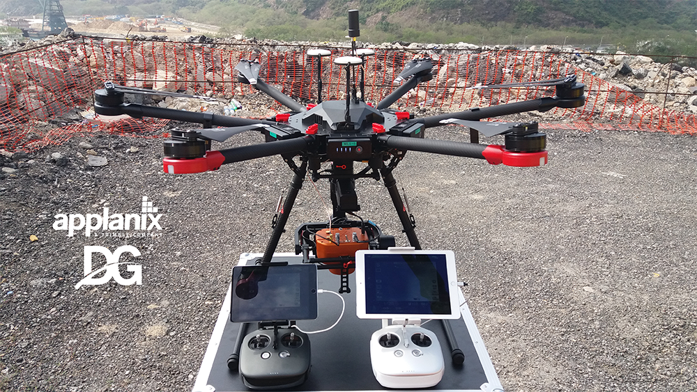
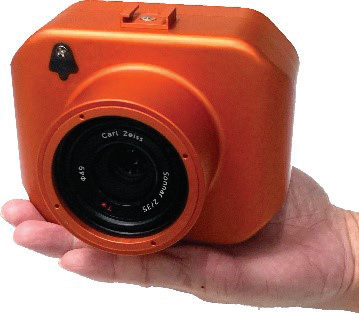
AS Vision 的 AMC SS(Single and Simple)相机是一款完全校准的测绘相机,由 Applanix APX-15 无人机 GNSS 惯性系统提供动力。AMC SS 的总重量不到 1 公斤,配备 42 MP 相机,适用于使用旋转翼和固定翼飞机的低空应用。作为一款几何校准相机,它适用于高达 1:500 的传统摄影测量项目,地面控制点数量最少。
As a system integrator, AS Vision Limited is always looking for the optimal technology and workflow for accurate aerial surveying from UAVs, and Direct Georeferencing technology by Applanix is the perfect match.
The AMC SS (Single and Simple) camera from AS Vision is a fully calibrated mapping camera powered by Applanix APX-15 UAV GNSS-Inertial System. With a total weight less than 1Kg, the AMC SS features a 42 MegaPixel camera for low altitude applications using rotary and fixed wing aircraft. As a geometric calibrated camera, it is suitable for traditional photogrammetry projects up to 1:500 with minimum amount of Ground Control Points.

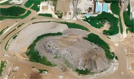
DSM production (by Nadir image capture)

Point Clouds generation (by oblique image capture)
AMC SS 采用直接地理配准技术,可以:
- 在偏远地区快速生成正射影像,而无需地面控制点;
- 在具有挑战性的环境中提供最佳工作流程山体滑坡等环境;
- 创建用于搜索、救援和破坏的 3D 模型评估;
- 创建用于危险规划的详细信息,以及预防。
Featuring Direct Georeferencing technology, the AMC SS can:
- generate orthophotos rapidly in remote areas without Ground Control Points;
- provide an optimal workflow in challenging environments such as landslides;
- create 3D models for search and rescue and damage assessments;
- create detailed information for hazard planning and prevention.
通过 Applanix 的直接地理配准将您的无人机变成专业级的测绘解决方案!
Applanix 将其在多频、多星座差分 GNSS 和基于惯性的定位和定向方面数十年的经验与最好的小型硬件和强大的软件相结合,为无人机上的专业航空测绘提供 DG 解决方案:
- 专为无人驾驶航空环境而构建
- 坚固耐用、重量轻、功能强大且精度高
主要特点
- 可集成到大多数无人机
- 无人机的轻量级摄像头解决方案
- 200Hz POS 集成
- 不使用地面控制点的地理配准
- 相机校准的 USGS 格式
Turn Your UAV into a Professional-grade Mapping Solution with Direct Georeferencing from Applanix!
Applanix has brought together its decades of experience in multi-frequency, multi-constellation Differential GNSS and inertial-based positioning and orientation with the very best in small form-factor hardware and powerful software, to produce a DG solution for professional aerial mapping on UAVs:
- built for the unmanned aerial environment
- rugged, lightweight, powerful and high accuracy
KEY FEATURES
- Can be integrated into most UAVs
- Lightweight camera solution for UAVs
- 200Hz POS integration
- Georeferencing without Ground Control Points
- USGS format of camera calibration
关于 AS VISION ABOUT AS VISION
AS VISION Limited 成立于中国香港特别行政区。公司主营业务为多镜头航拍相机的开发,提供包括传统、倾斜和无人机摄影测量应用与POS AV™在内的一系列解决方案。
- 无人机解决方案:AMC SS、AMC DD(近红外 + RGB)
- 传统平台:AMC Panoblique TM、AMC180
(与 Phase One 一起建造)
AS VISION Limited was established in Hong Kong SAR, China. The company’s main business is the development of multi-lens aerial cameras, providing a series of solutions including a traditional, oblique and UAV photogrammetry application with POS AV™.
- UAV solution: AMC SS, AMC DD (Near Infrared + RGB)
- Traditional platform: AMC Panoblique TM, AMC180
(built with Phase One)
关于 APPLANIX ABOUT APPLANIX
Applanix 是 Trimble 公司(纳斯达克股票代码:TRMB)旗下公司,致力于开发、制造、销售和支持用于移动测绘和定位的产品和解决方案。
Applanix 的产品和解决方案用于各种应用,包括道路剖面、GIS 数据采集、航空测绘、铁路轨道维护和海底测绘。Applanix 成立于 1991 年,以其卓越的服务支持其不断增长的全球客户群。
Applanix, a Trimble Company (NASDAQ: TRMB), develops, manufactures, sells and supports products and solutions for mobile mapping and positioning.
Applanix’ products and solutions are used in a variety of applications, including road profiling, GIS data acquisition, aerial surveying and mapping, railroad track maintenance and seafloor mapping. Established in 1991, Applanix supports its growing global customer base with exceptional service
🔗:https://www.applanix.com/news/as-vision-mapping-applanix-dg/
.png)
