.png)
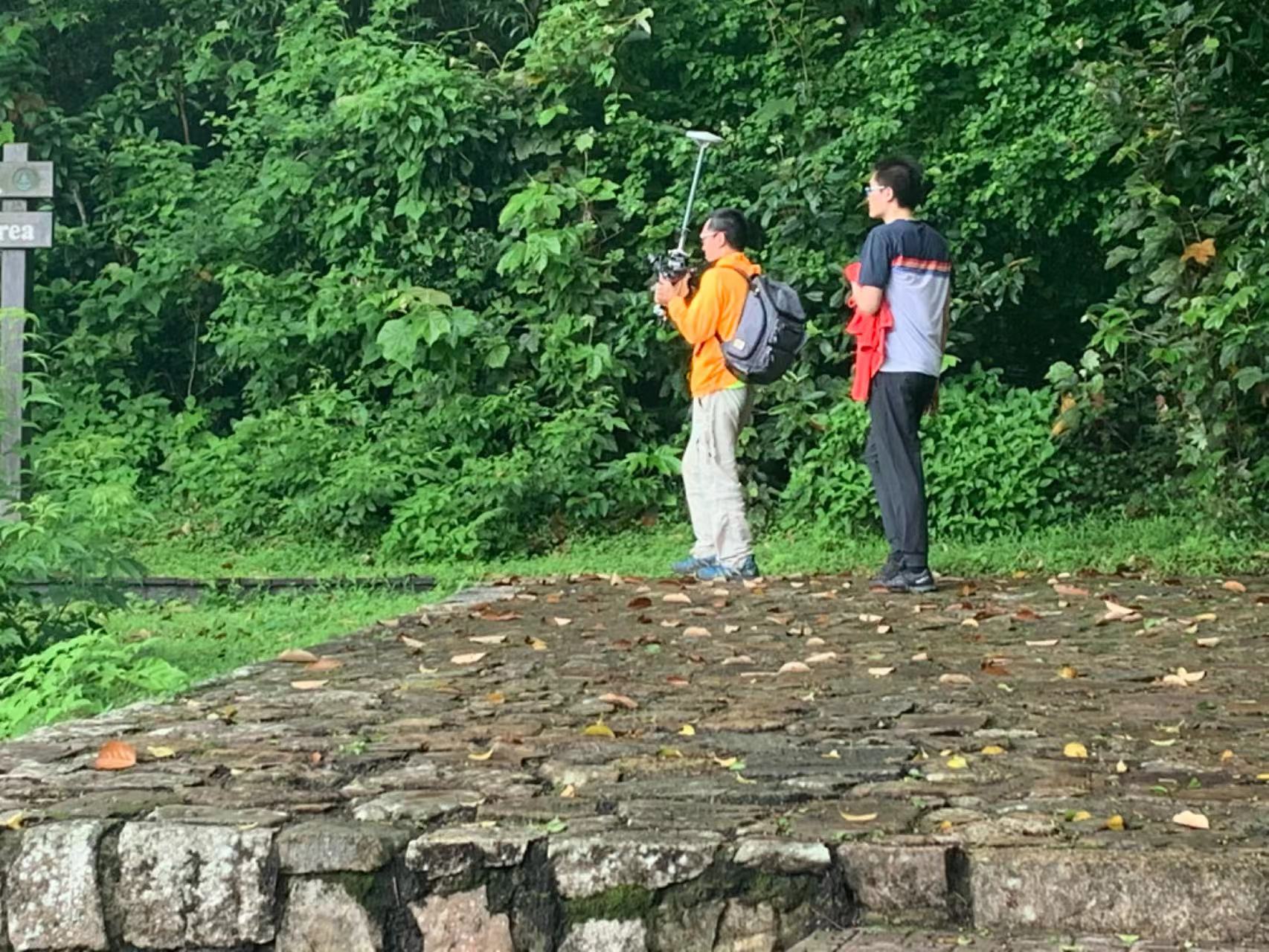
相機是我們自主研發的amc DD相機
LCW(荔枝窩) 村是一个相对较大、保存完好的围墙村庄,建于 300 多年前,从粤北、江西和福建迁移到沙头角的客家人等。在清初撤离诏令被废除后。沙头居民Kok 成立了 10 个地方村际联盟,称为 Shap Yeuk (十約) 以维持地方安全(例如抵抗该地区的海盗和强大的氏族)并处理内部的纠纷。特别是 LCW 和六 (6) 个邻近村庄,即 So Lo Pun (鎖羅盆), Sam A (三椏),Mui Tsz Lam (梅子林), Kop Tong (蛤塘), Siu Tan (小灘)和牛世湖组成第九个联盟,称为兴春約(慶春約,HCY)。还有另外两 (2) 个邻近的客家村落,即谷埔 (Kuk Po)和 Fung Hang (鳳坑),位于 LCW 以西,曾居住着不同的氏族。大约在同一时期,保留了许多传统风格的建筑和习俗。在这些 HCY 和邻近村庄,由于他们远离市区,自 1951 年起,沙头角被指定为边境禁区,限制游客进入这些村庄。
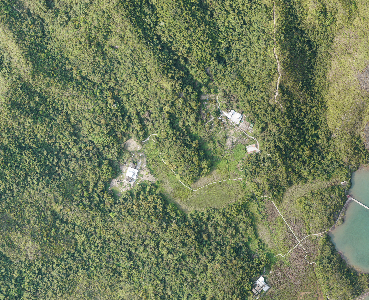
为方便有效评估工地状况(例如村屋配置、人行道和天然溪流路堤条件等)和未成年人的规划,LCW 的改进工程,一项使用摄影测量和/或其他方法的试点地理空间测量,2019 年进行了先进的测量技术以测试能力和调查技术的性能,以期建立LCW 模型。使用从试点收集的数据构建 LCW 模型、地理空间调查,建议将地理空间调查扩展到 HCY 和邻近地区LCW 周围的村庄,考虑到获得的经验,并采取适当的措施对试点地理空间中使用的测量和模型构建技术的修改调查。具有 HCY 街景的照片级 3D (3D) 模型和LCW 周围的邻近村庄也建议根据收集到的数据进行建设来自地理空间调查和其他可用来源,以允许用户更好地可视化和欣赏这些村庄的环境。
LCW(荔枝窩) Village is a relatively large, well-preserved walled village built over 300 years ago by the Hakka people who migrate to Sha Tau Kok from northern Guangdong, Jiangxi and Fujian,etc. after the Evacuation Edict was rescinded in the early Qing dynasty. Residents in Sha Tau Kok formed ten local inter-village alliances called Shap Yeuk (十約) to maintain local security (e.g. to resist pirates and powerful clans in the region) and to handle disputes within the villages. In particular, LCW and six (6) neighbouring villages, namely So Lo Pun (鎖羅盆), Sam A (三椏), Mui Tsz Lam (梅子林), Kop Tong (蛤塘), Siu Tan (小灘)and Ngau Shi Wu (牛屎湖), formed the ninth alliance called Hing Chun Yeuk (慶春約,HCY). There were two (2) other neighbouring Hakka villages, namely Kuk Po (谷埔)and Fung Hang (鳳坑), to the West of LCW which had been inhabited by different clans in about the same period. Many traditional styles of architecture and customs are preserved in these HCY and neighbouring villages, due to their remoteness from the urban areas and the designation of Sha Tau Kok as a Frontier Closed Area from 1951, limiting visitors to these villages.
To facilitate the effective evaluation of the site condition (e.g. village house configuration,footpath and natural stream embankment conditions, etc.) and the planning of minor improvement works in LCW, a pilot geospatial survey using photogrammetry and/or other advanced surveying technology was conducted in 2019 for testing the capability and performance of the survey technologies with a view to establishing a baseline condition of
LCW. Following the building of the LCW model using the data collected from the pilot geospatial survey, it is proposed to extend the geospatial surveys to the HCY and neighbouring villages around LCW taking into account the experience gained and with suitable modification to the surveying and model building techniques used in the pilot geospatial survey. Photorealistic 3-Dimensional (3D) models with street views of the HCY and
neighbouring villages around LCW are also proposed to be built based on the data collected from the geospatial surveys and other available sources, to allow users to better visualize and appreciate the environment of these villages.